Original 1836 Antique Pre-Civil War Map SOUTHERN STATES Georgia Florida Alabama
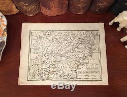
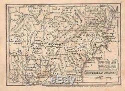



Fine Adornment of Southern History. 1836 Map of The Southern States Steel-Plate Engraved. Original Steel Engraved Map of the 1836 Edition of The First Book of History, Combined with Geography; Containing the History and Geography of The Western Hemisphere, by the Author of Peter Parley's Tales; Illustrated by Engravings and Colored Maps; Published 1836 by Charles J.
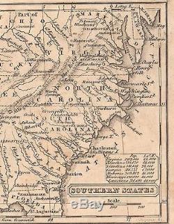
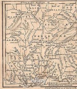
Palmer & Company: Boston, 1836; a copy of the Title Page of which is Included. A Fine Map for the Decorator, Historian, and Collector. Impressive On Any Home or Office Wall Dimensions: 4 7/8" x 6 3/4" Fine Adornment of Southern History. Great for History and Family Genealogy, as Map shows Cities, Towns, & Landmarks During 1836, Some of Which No Longer Exist Today. Makes an Imaginative & Creative Gift.
Greetings from Historical Savannah, Georgia: Founded 1733. Press the Link Above to Visit Store.
Some, to beautify their parlors, chambers, and studies.... Loveth, getteth, and useth maps, charts, and geographical globes.
John Dee, Advisor to Queen Elizabeth I. The item "Original 1836 Antique Pre-Civil War Map SOUTHERN STATES Georgia Florida Alabama" is in sale since Wednesday, May 17, 2017. This item is in the category "Antiques\Maps, Atlases & Globes\North America Maps".
The seller is "jonesjackson" and is located in Savannah, Georgia. This item can be shipped worldwide.
- Type: States Map
- Maker: Charles J. Hendee
- Original/Reproduction: Antique Original
- Map View: Western Hemisphere
- Continent: North America
- Country/Region: United States of America
- North America States & Provinces: Alabama
- Year: 1836
- Format: Engraved
- Printing Technique: Steel Plate
- Date Range: 1800-1899

